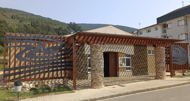
Courel Mountains Geopark includes the municipalities of Quiroga, Folgoso do Courel and Ribas de Sil, in the south of the province of Lugo, and it is one of the great natural and cultural values of Galicia (northwest of Spain).
In its 578 km2 of extension, this territory includes from the valley of the river Sil in the south, where the biggest populations settle, to the mountains of O Courel in the north, where more than 50 suggestive traditional villages are hidden.
The Courel Mountains treasure a rich and varied geological heritage closely related to the use of rocks for construction, industrial minerals and other geological resources, since prehistoric times.
This Geological Heritage has a marked tectonic and geomorphological character, in which the Global Geosite called “recumbent folds of the Courel Mountains” stands out at an international level.
The Municipal Geological Museum of Quiroga is one of the pillars of the Courel Mountains Geopark and is part of its network of interpretation centres, such as the Devesa da Rogueira Nature Classroom, or the Meiraos Caves Interpretation Centre, the Quiroga Ethnographic Museum and the Roman gold mining museum in Ribas de Sil.
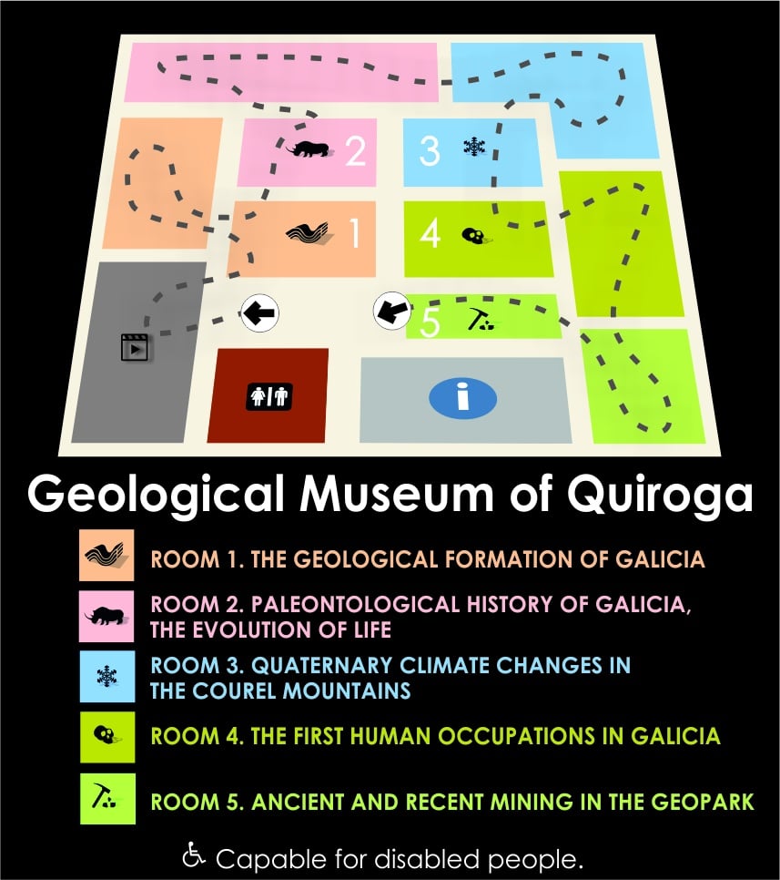
The Quiroga Museum includes the most representative geological contents of the surroundings, arranged from the oldest to the most modern, in five rooms, with the following content:

Analysis of the main geological events that define the Galician territory as we know it today. Through palaeographic reconstructions we understand how plate tectonics lead to the formation and folding of Galician rocks, including the famous International Campodola- Leixazos recumbent fold (Sinclinal da Serra de O Courel).
Moreover, this room shows a complete collection of the most representative rocks and minerals of the Geopark as an example of the great geodiversity of the environment, most of it thanks to voluntary donations from the Museum collaborators. The collection includes igneous, metamorphic and sedimentary rocks, as well as very rare minerals that were exploited since the arrival of the Romans.
O Courel Mountains Geopark constitutes an exceptional environment for the study of the evolution of life in the northwest of the Iberian Peninsula during the Paleozoic and Quaternary periods. Among the Paleozoic fauna, invertebrate animals such as trilobites, cephalopods, graptolites, archaeocids, crinoids and brachiopods stand out. These animals inhabited the seas where most of the rocks in the Geopark were formed.
Although the most spectacular of Courel Mountains are the remains of the surprising and unknown fauna of the Galician Quaternary, mainly investigated by the University Institute of Geology of the University of A Coruña. Dita fauna buys mainly large macromammals such as cave and brown bears, bison, mammoths, woolly rhinoceroses, deer...
.

The discovery and exploration of the caves in the Courel Mountains opened a fascinating window for the knowledge of the climates and environments of our past, both locally and globally. The speleothems hidden in the caves of the Geopark constitute exceptional paleoclimatic records that detailed the evolution of the temperature and humidity of our planet, as is the case of the stalagmite of the Arcoia Cave shown in this room, which began to grow 550,000 years ago and was studied by researchers from the Geology University Institute of the Coruña University.
The climatic variations registered in the stalagmites are compared, among others, with global climatic changes, which include glacial and interglacial periods, and with the advances and retreats of the glaciers that occupied the summits of the Courel Mountains in the past. The dynamics of these Pleistocene glaciers were reconstructed from glacial sediments and the geomorphological forms they left in the current relief, such as the Devesa de A Rogueira cirque. The panels in the room illustrate how the current forms of the relief are superimposed on the old position of the glacial fronts from the moment of the maximum local glacial extension until the end of the deglaciation, when the Lucenza Lagoon was formed in a glacial over-excavation basin. This lagoon registered the changes in the surrounding vegetation since the last 10,000 years, including the arrival of the chestnut tree or agriculture 4,000 years ago.
This room shows a simple overview of the evolution of hominids, always under scientific review and debate, from our African ancestors to the current Homo Sapiens. It is a phylogenetic tree with the different hominid species that emerged in the past, and which became extinct one after another, with one single exception: us.
The Palaeolithic tools found in the Gándara Cha, in the parish of La Ermida, only 2 km away from the Geological Museum, place the Courel Mountains Geopark on the map of Galicia's Prehistory, in one of the probable main lines of migration that followed the valley of the river Sil. These tools, composed of just over 100 pieces, were carved in the geological materials of the region, quartz and quartzite of fine and coarse grain. In addition, the different ways of manufacturing these tools in stone thousands of years old are illustrated.
From the north of the Mountains of O Courel, in the Pedrafita do Cebreiro Council, come the human fossil remains of the so-called Elba, the shepherdess of O Courel, who travelled these mountains 9,500 years ago. Her study, led by the University Institute of Geology at A Coruña University, allowed us to know how Elba really was by means of a reconstruction based on her genetic code, preserved in the DNA of her bones.
The mountains of O Courel comprise one of the most important mining regions of Galicia, so the last room of the Museum is dedicated to the mining exploitation that took place from Prehistoric times to the present day. The most important geological materials
There were five: slate, gold, iron, limestone and antimonite, of which only slate survives as one of the economic engines of Quiroga and Folgoso do Courel. However, galena, tungsten, silver, and even mercury and copper were also exploited somewhere in the Geopark. In addition to this, quartzite is still exploited for aggregates in Ribas de Sil.
The main characteristics that made the rocks and minerals of Courel Mountains key to its development, what they were used for, how they appear in the natural environment and the main deposits of each one, are analyzed. Furthermore, the main exploitation systems and their evolution in time are highlighted, including the current technologies used in the exploitation of slate, the main protagonist of these mountains since Prehistory.

